Users with GPS data can now annotate their runs within route maps!
Annotations allow you to identify events or points of interest within a specific run. It’s got some pretty awesome use cases including, but not limited to:
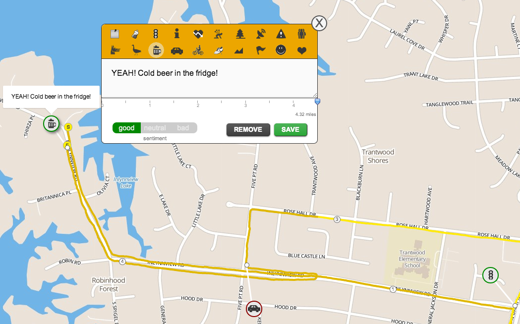
- Tagging water stops on a race route
- Noting the distance marker(s) where you paused because of a stoplight
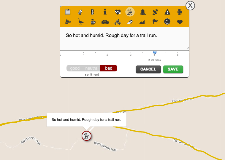
- Indicating where the hills are located along a trail
- Elaborating on u-turns because of dogs and/or geese
It’s also super easy to use! Start by going to a recent run with a route map and click on the outline of your map. Once the map is loaded, just click on the notepad icon on the top left.

The icons across the top of the modal are your different markers. Mouse over each one to see what they represent. The slider shows you where the annotation goes. You can also associate a sentiment (good, neutral, or bad) for all the different icons.
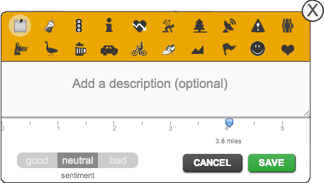
We made descriptions optional, but it’s much nicer to mouse over an annotation and see a little tooltip about that part of your run.
Editing your annotations is also very easy. Just click on any of the annotations you added (or mouse over it and click on the tooltip, if you added a description) and that will reopen the modal. If you change your mind about the annotation, you’ll also see the option to remove it while editing.
Check it out and let us know if you have any questions. In addition, we also released a patch that should sort out the mismatched “fastest runs of a similar distance”, which affected a couple of users. Otherwise, we hope you like the new feature!
I just OMFGasmed. That’s awesome. Here’s hoping this works with the run I just did.
Just tried it, this is really awesome! great job!
wow. you just blew away other run logging sites..
[…] I mean, I like dealing with numbers but I thoroughly dislike QuickBooks. We also rolled out annotated runs and we’ve been busy working on weekly reports. It’s been ridiculous trying to re-wire […]
You ain’t seen nothing yet.